给加州部分地区带来罕见降雪的大规模冬季风暴正在席卷全国,威胁着东海岸。
周日,南加州将会从强烈的雨雪天气中得到喘息的机会。主要的风暴系统正在给大平原带来破坏性的雷暴。
超过8000万美国人目前处于大风或冬季天气的警戒状态。
俄克拉荷马州西部周日将出现大部分恶劣天气,阵风可能达到每小时80英里至110英里。天气预报显示,得克萨斯州北部和堪萨斯州东南部将遭遇带有破坏性大风、大冰雹和分散龙卷风的风暴。
该系列风暴将于周日下午晚些时候在德克萨斯州的狭长地带开始,然后在密苏里州部分地区持续一整夜的破坏性风力威胁。
到周日晚上,中西部还将经历倾盆大雨,到周一早上变成寒冷的天气,这对芝加哥地区的人们来说是一个挑战。
预计风暴系统将在西海岸逗留并给一些地区带来几英寸的雨雪后向东推进。
在五大湖地区,预计威斯康星州、密歇根州和东北部会有降雪。密歇根州数十万用户已经断电。公用事业公司热能和消费者能源说电力会在即将到来的风暴到来之前恢复。
周一晚上到周二,一段时间的降雪和寒冷可能会给I-95走廊沿线的城市带来积雪。
纽约市、纽黑文、康涅狄格、普罗维登斯、罗德岛和波士顿等城市的降雪不足,预计这场风暴系统将带来几英寸的积雪和融雪。周二早上可能是穿越东北部的混乱通勤。
南加州发布了罕见的暴风雪警告,给圣加布里埃尔和圣贝纳迪诺山区带来了几英尺的积雪。好莱坞山和旧金山周围的山上甚至下起了一层小雪。
在周末的某个时间点,像加利福尼亚箭头湖这样的地方,降雪量达到每小时2.5英寸。在洛杉矶郊外的山区,自周三以来已经有2到6英尺的降雪。
星期六,超过126,000名客户在加州没有电力供应。超过2500次航班被取消上周预计会有暴风雨。
另一个风暴系统也将于周日晚些时候在加州北部登陆,带来更多的阵风和难以置信的高山积雪。
随着天气的到来,从西雅图到萨克拉门托的西海岸都发出了冬季警报。内华达山脉将会有3到7英尺的降雪。
周一早上,加州的其他地区将会看到更多的雨雪向岸上移动。
Massive winter storm that brought rare snow to parts of California now moving east
The massive winter storm that brought rare snowfall to parts of California is threatening to do the same on the East Coast as it moves furiously across the country.
Southern California will finally get a reprieve on Sunday from the intense rain and snow. The major storm system is now bringing damaging thunderstorms to the Great Plains.
More than 80 million Americans are currently under alert for wind or winter weather.
Western Oklahoma will see the bulk of the severe weather on Sunday, with wind gusts of 80 mph to 110 mph possible. Northern Texas and southeastern Kansas will experience storms with damaging winds, large hail and scattered tornadoes, forecasts show.
The line of storms will initiate in the Texas Panhandle during the late afternoon on Sunday before continuing with a damaging wind threat through the overnight hours in parts of Missouri.
By Sunday night, the Midwest will also be experiencing pouring rain that changes to a wintry mix by Monday morning, making for a challenging commute for those in the Chicago region.
The storm system is then expected to slingshot eastward after lingering on the West Coast and dumping several inches of rain and snow to some regions.
In the Great Lakes region, snow is expected in Wisconsin, Michigan and the Northeast. Hundreds of thousands of customers in Michigan are already without power. Utility companiesDTE EnergyandConsumers Energysaid power would be restored before the upcoming storm hit.
On Monday evening and into Tuesday, a period of snow and wintry mix will likely bring accumulations to cities along the I-95 corridor.

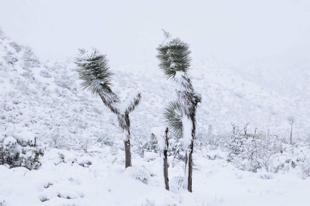
Desert flora is covered in snow in Phelan, Calif., on Feb. 25, 2023.
David Swanson/Reuters
The snow deficit in cities like New York City, New Haven, Connecticut, Providence, Rhode Island, and Boston will likely chip away with several inches of snow and slush expected from this storm system. Tuesday morning could be a messy commute across the Northeast.
A rare blizzard warning was issued for Southern California, bringing several feet of snow to the San Gabriel and San Bernardino mountains. A dusting of snow even reached the Hollywood Hills and the hills around San Francisco.
At one point over the weekend, snow was falling at rates of 2.5 inches per hourin places like Lake Arrowhead, California. In the mountains outside of Los Angeles, anywhere from 2 to 6 feet of snow have fallen since Wednesday.
On Saturday,more than 126,000 customerswere without power in California. More than2,500 flights were canceledlast week in anticipation of the storm.
Another storm system is also moving on shore in Northern California later on Sunday, bringing more gusty winds and incredible amounts of mountain snow.
Winter alerts are in effect on the West Coast from Seattle to Sacramento as the weather moves in. The Sierra Nevada mountain range will see between 3 and 7 feet of snow.
Others parts of California will see more waves of rain and snow moving onshore on Monday morning.


